Tuesday 16 June 2015

Leeds, Landscapes, Lives : A Preview

This is the last post of the module - and a reflection on the culmination of the many activities which we've been leading over the term, from app development to evaluation to exhibition curation and publicity. 

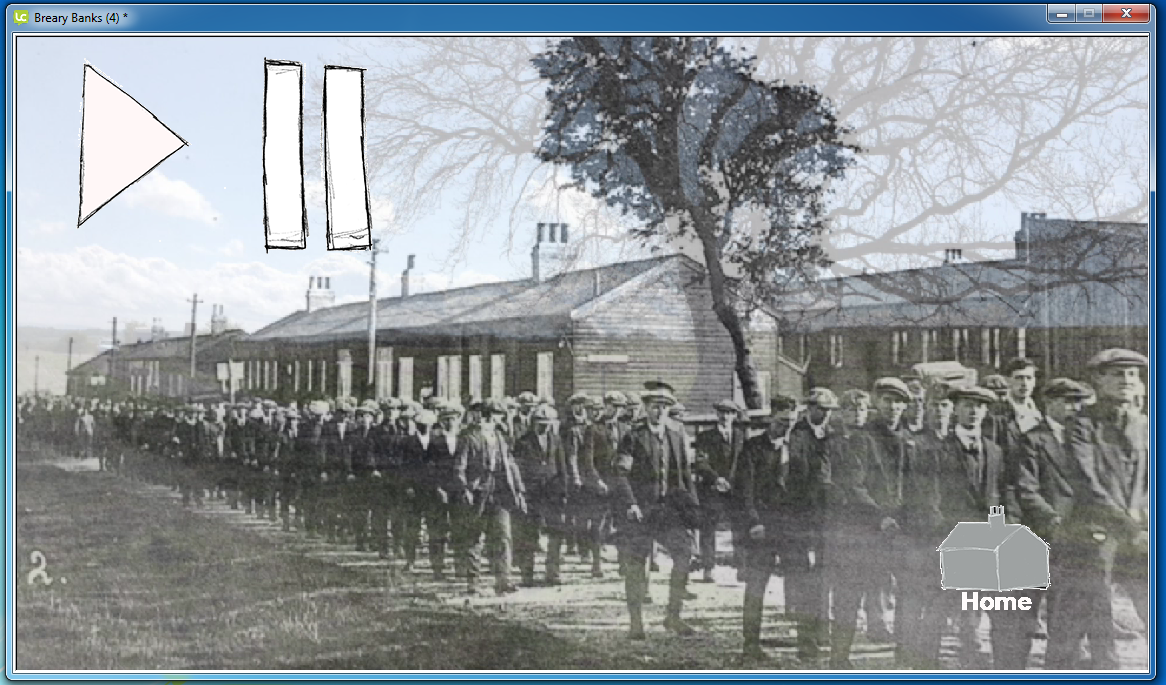
We spent time over the past couple of weeks gathering input on our mobile app to finalise its development. Feedback from the various stakeholders of the app was a little thin on the ground, but the responses we did get were not too problematic. For example, it was commented that the app had a lack of some visual clues as to where the user was in relation to the site of Breary Banks (notably the Memorial). But if you've ever been to the site before, you'll know that the memorial is palpable in terms of how to orientate yourself. Other minor issues raised included the need for some definition in the audio and whether the app would have worked in a portrait orientation. I disagree with the last bit of feedback, as the visual imagery especially, needed to be landscape to get the full effect and because it is first and foremost an audio guide, visitors will probably expect something slightly different to a standard mobile app. So, nothing to worry about so far...!

We fixed the app in line with this feedback, and from there we went on to set up the year-end exhibition, Sense Of Community. We drafted a Press Release, which was published on the Archaeology Department's website. And we designed and printed a programme for the exhibition to accompany our posters and social media advertising. 

We set up a voting station for visitors to vote for the winners of the best digital presentations for the sites of both Star Carr and Breary Banks. The morning of the exhibition was put aside to set up the room (which included moving a rather large horse skeleton from the room...) and to go about the grueling task of making sure every computer/laptop/iPad/headphone was working and had the correct presentation on it! By this time I had seen every panel at least twice, but 4pm came quickly and the room was filled with people eager to see what this year's exhibition entailed. The event was a huge success with positive comments for everyone's hard work and nearly 260 votes cast for the winning presentations. It was also nice to be able to catch up with the rest of the students in the blazing hot sunshine and wish them a great summer. 

This is a screen recording of use of the audio guide which has been uploaded to YouTube. In the future, Archaeology and Heritage Students will be adding to it and making it more accessible as an actual app for mobile devices. In the first instance, this was a proof of concept, and we're happy to report that it's been a successful endeavour.

For those of you out there who would like to view the recording of the app in use, here is the link:


And finally, thanks to all of you around the world for reading this blog. I hope you've got a glimpse into what it's like for a first-time student to experience working in the Heritage Sector, and why not visit Breary Banks one day? (Although, maybe in the Summer because you've probably guessed how unpredictable British weather is!)  :-)

Thursday 28 May 2015

App Accomplished

The absolute final steps of modifying and completing the app had to be finished by the end of last week (ish). From the invaluable points of improvement provided to me by those testing the app at Breary Banks, I was then able to alter the scripts of the audio for each stop and record myself (which did get a bit repetitive!). For the Memorial and Tree stops, all that was needed was to give practical guidance to the audience, for example to point out that the site was private property and not to enter the fields (otherwise, the sheep wouldn't be too happy!). However, the final audio for the trench had to be changed quite drastically due to the difficulty of navigating yourself to the position on the pathway. The other two stops were very emotive and engaged with the participant's senses so that they feel more involved with the landscape's history. This injection of appealing to the audience's imagination had to be inserted into this script, for example, imagining the sounds of boots marching, the soldiers 'chatting' to one another, which I think added to the content and individual stories. 

Once again, we spent most of the day with Tom Smith, to work on the visual effects on LiveCode for each stop. The idea for the Tree stop was to dissolve a photograph taken by us with one taken 100 years ago to give the audience an idea of the structure of the camp and how to orientate themselves, and then loop the imagery. To do this, we created a video using iMovie, with text inserted to differentiate the different time periods (but it's pretty obvious when you look at them both). 
Screen shot of the present day 'tree stop' 
Screen shot of the dissolved effect from the present day to 100 years ago
Following on from this, I had to create a similar effect on the Trench stop, as those who've tested it on site commented on the confusion of finding the firing range and the focusing on the connection to the audio. By creating yet another video using the same software, I was able to use the photo we took on site and highlight the firing range and zoom in, so that the audience can look at their screen and be able to see what they are meant to be seeing! This worked really well, as now you won't be worrying that you are looking at the wrong field, and you'll be able to engage with the audio and the surrounding landscape. 
And finally, the Map page had to be modified so that each stop was easy to find, going in an upwards formation up the road/pathway. 

Screen shot of the firing range being brought into focus.

Screen shot of the transition from the above image to a close up image of the
firing range.
Screen shot of the firing range which will be seen on the mobile's screen.
Screen shot of the 'Map' page, we've circled the three stops so visitors can
direct themselves and have a more direct impression of how the app operates. 
Hopefully, now, this is the end! Since going to Breary Banks to see how the first draft worked, it made me realize how beneficial it was for the whole organisation of the app and to highlight other practicalities that were thrown at us. For me, only being on site for 5 days caused a few problems in that I had to take in every detail straight away, from where visitors would be parking which would dictate where my first stop would be (this would most likely be by the Memorial), having to state that the site was under private ownership and the weather played a big factor in what the audience will be able to see or not see. Now, the next step is to send the app and get feedback from various stakeholders, other staff members in the Department here in York and the Nidderdale First World War Project, such as Amanda Walters who supplied us with invaluable resources and information. I've devised a survey in which those who receive the app can write as much or as little as they want about each individual stop. They probably won't be able to make it to the site to test it out for the full experience (most likely, they'll be in a warm, wind-free room, which is not what Breary Banks is like at all!), but by getting their critical responses, we will know whether we have satisfied the expectations of bringing Breary Banks closer to the public and being more accessible. 

Monday 18 May 2015

Time to Tweak

After the madness of last week, we were finally going to see how the app was going to work on site. It was the last day of excavating, so this was our last chance to be able to test the overall format and use of the app with others (such as students and supervisors) to get their responses. 

For practical reasons and to avoid confusion with the participants, the whole app was made into a video, so the cursor would move by itself to each stop, therefore the participants would only have to press 'pause' to stop the video after each stop. Both Sara and I used the guide when we first arrived, and it wasn't as bad as I expected! Our main improvements were the quality of the audio, which was slightly crackly making my voice sound slightly robotic and some of the content/order of content might have to be re-arranged and re-written.  
Me taking Dr Jonathan Finch through the format of the app
(photo by Dr Sara Perry)
Me taking a student through the app
(photo by Dr Sara Perry)
I guided and recorded the module leader for the Excavation Fieldschool, Dr Jonathan Finch, and two students who had been taking part in the excavation for the last three weeks through the app. There were no major faults that were detected, just little niggles that could've been portrayed better. For example, the 'Trench' stop is probably the most problematic in being able to navigate where you are supposed to look, especially if you didn't even know there were training trenches there! We found a way around it, replacing the existing visual imagery on the screen with a photograph of the fields that the participant is meant to be focusing on, annotated to illustrate the features. Other than some of the content being re-written or being put in another order, the differences between someone who knows a lot about the site's content and students who haven't been able to appreciate the wider landscape because they've been covered in mud all day was quite apparent. Jonathan mostly picked up on the content, whereas the students picked up on trying to be more specific in clarifying particular features. 

The day finished around 2pm, and as a celebration of finishing the excavation, we all went for a tour around Theakston's Brewery Visitor Centre in the nearest village of Masham and enjoyed a free drink - which certainly woke everybody up!

Next, time to completely finish the app! 

Tuesday 12 May 2015

Perspectives

To understand the makings of a museum environment and the behind-the-scenes experience, I undertook a day of volunteering at the Yorkshire Museum in the centre of York. For most of the day, I was based in the Roman Gallery interacting with members of the public, conducting a survey about how the displays and the overall presentation could be improved. As I progressed through the day of listening to the same video over and over again, I actually had some very pleasant conversations with people, who enjoyed their experience of the Museum and its beautiful surroundings. However, as you can imagine, on a sunny Friday, it was pretty quiet. Kids soon emerged and dictated where the adults went, so that was fun and loud. At about 3pm, the Curator of Archaeology, Natalie McCaul, saved me from standing up any longer and asked me to do some research for a teaching programme, on an Iron Age bronze and copper alloy horned God, quite possibly Brigantia, the Goddess of the tribe Brigantes who was situated in the North of England. 
Replica of a Roman mosaic floor in the gallery (photo by author)
It was interesting to see how other forms of communication in interpreting archaeology and heritage are incorporated into the format of a museum. From experience, museums can have too much information to take in and you can feel a bit lost as its content has to appeal to multiple audiences. You normally have to visit a few more times to feel that you have covered the whole spectrum of its information. But the Yorkshire Museum's multisensory and interactive content is engaging and well done. So much so that I went back again the next day as a visitor!

In relation to my app, its content will be minimal in comparison to that of a museum. Being an audio guide also will enhance the user's engagement and be more of a tactile experience with the surroundings. I appreciate the work that museums do and was grateful for my time there. It's made me realize that heritage interpretation is varied and is being developed constantly to satisfy the user's participation. 

Working Wonders

Early last week, it was full steam ahead. After collecting all the appropriate content for the audio, my Module Leader, Dr Sara Perry, went to site whilst I stayed in York writing up the scripts for each individual stop. By doing it this way, I could then email the scripts to her and then Sara would read it out loud to see how long the breaks in between paragraphs would be, whether the directions I was giving were relevant and easy to follow, etc. Because I wasn't present on site, it made it a lot harder for me to orientate myself! Sara then emailed me back the script for me to record. I had decided not to have the Chapel as a stop, purely because I could not find enough content to support the audio, which was a shame as no one seems to know an awful lot about it. This back-and-forth process, with one of us on site, and one back in the lab at York was actually really effective, and highlighted the importance of getting the audio and other content right in terms of its connection to the landscape.


Mind map for the app title
(photo by author)
Back at King's Manor, the whole first draft of the app had to be completed. Once again, Simon Davis was on hand to assist in editing the three scripts on the software, Audacity. When I was in my room on campus recording the audio, I was conscious of getting the right tone, so not to sound too enthusiastic but to not sound monotone and uninterested, so finding my 'voice' if you like took a while. Listening back to the audio, there were background noises (shuffling paper, breathing etc), long gaps which proved unnecessary and some stumbles/re-starting of sentences which obviously had to be erased. I learnt that you could spend hours on one recording to get it spot on, but we had 2 hours to ideally do three recordings - so it was quite repetitive in listening to the same bits over and over again! I learnt that I had to be brutal in erasing the pauses, again, by not being on site and not knowing how long the user would need to break for (to look for certain features etc) was tricky. So after 2 hours, I had one recording which was cut down from 6 minutes to about 2 and a half, the process feeling very long, but the outcome being very short!


A screen shot of deleting background noise in Audacity (photo by author)
Screen shot of home page of mobile app (photo by author)

I was then able to edit the other two scripts back on campus, ready for the following Monday, when both Sara and I would test the app on-site. Following on from this, in the afternoon we met up with Tom Smith once again, so we could construct and finalize the app's format on LiveCode. We began by designing the home page: I'd done a black and white sketch (well, a pencil sketch), which we scanned into the Drive and then I drew an outline of the huts that would've been the focal point of the site. These huts we thought could be the buttons to lead you from one stop to the next, but we ended up lining them up next to each other, to create the illusion of them being how they would've been 100 years ago. My next task was to learn how to import audio into the app. On each card I had inserted two buttons, a 'play' and a 'pause' one which would then correlate to the playing and pausing of the audio. By selecting the button, and clicking on 'code', I was then able to insert a script code as to what I wanted the button to do once I clicked on it. I then repeated this method for the next two cards. 


Screen shot of importing audio (photo by author)

After a whole day of basically making the entire app, making sure the visual imagery, the audio, the content and the design of the app was usable (at least), I then was able to continue this process over the weekend of completing the editing of the audio, making sure the codes were in the right place and took you to the right page and any other small details were perfected. Then hopefully, it will all work out on the Monday! 

Tuesday 5 May 2015

Stop By Stop

Entrance to Breary Banks, with a few sheep! Credit to Alice Toso
Being chased out of a field by a flock of sheep was not something I expected to happen whilst I was on site last week. They certainly made themselves known! I went to site to gather more content about the history of the site, to establish my four 'stops' for our forthcoming audio guide and to get a firsthand account of the changeable weather that is unpredictable, to say the least. Before I went to site, I was introduced by the university's E-Learning Adviser, Simon Davis, to a computer software called Audacity, which enables you to edit all formats of audio. I will use this once my four recordings have been completed to ensure my audience can clearly understand the spoken content for each stop. Since the weather in the remote village of Colsterdale is pretty erratic, it would be preferable to record each audio file in a quiet studio/room, so no interference is detected. I was also presented, by the university's Collaborative Software Specialist Tom Smith, with another resource called LiveCode, which will provide my framework for building my app, so I will be able to insert commands and audio within a card that will measure up to the format and size of an iPhone 5 (and, eventually, other mobile devices).


A long-standing feature of the site and a stop for the app
Credit to Alice Toso
By having this information at my fingertips, I was then able to develop a storyboard of what my app would look like visually and interactively. It will be fairly fragmented, as the stops can be accessed and listened to in any order. If you visit this site having downloaded the app, I would recommend starting at the Memorial to the Leeds Pals, as this is what sets the scene, if you like, by illustrating the context of the site. From there, you can either turn right to go back down to the start of the road, or turn left to go up to the end - either way, it doesn't really matter.


The entrance to the village, with the Chapel located to
the left of the image.
Credit to Alice Toso
The second stop could be the Chapel as you come up to the village, this is a Methodist Chapel built in 1911 and used by all the site's occupants. The third stop could be the ash tree that is to your left past the memorial, which is a prime focal point of the camp. This tree is in photographs from the start of the site's development in the early 1900s, and gives a good perspective of the structure of the landscape and the huts which once stood there. 

Finally, if you carry on past the tree, you come to a fork in the road, and to the right ahead of you, there is a firing range and a field which has trenches in it. This stop will highlight the training and 'handicrafts' that the soldiers had to master in order to survive and be prepared for the life of trench warfare and 'going over the top'. Depending on the different aspects of each stop, the audio will differ, experimenting with ways to make the audience consider possibilities associated with the site's usage and importance.

 
Myself interviewing Dr Jonathan Finch
Credit to Alice Toso

I went through the app's format quite a few times during the day, to make sure my audio will be descriptive and simple enough for listeners to follow. The module leader for the Excavation Fieldschool at Breary Banks is Dr Jonathan Finch, and I took him through the structure of the app last week and interviewed him as if he was a participant of the app guide. I asked him to describe what he sees from each stop, to divulge historical content that would aid me in my audio and to respond to any unanswered questions I had. This interview proved vital, in order for me to feel confident enough to produce an app that would do justice to the full potential of the wider landscape. 


Tuesday 28 April 2015

Apps 'n' Maps

As part of my research of how to develop my very own mobile app for Breary Banks, I rediscovered York's history by testing two apps to see how they navigated me to particular parts of the city. My first experience was the 'York Churches' app, which gives guided tours of all the churches in York's city center and is like an interactive website, in the sense that you don't have to necessarily be in the church to learn about its history. To locate the different churches, there is an excellent map of the city, with all the street names which is very accurate so you are able to find the church easily. Churches described as 'vanished churches' (ruins) are also plotted on the map, which is even better. No internet is needed either and the app gives you opening times and practical information about the church. 
18th Century Naval Figure 'The Little
Admiral' Clock. (drawing by author)
I went to explore St Martin's Church on Coney Street, with the famous 'Little Admiral Clock' being an immediate focal point. A panoramic view of the interior is available which directs you to different areas and objects, telling you about its history etc. Even though this was very easy to navigate, it almost focuses too much on particular areas such that you don't appreciate the church as a whole. Although, whilst I was walking round the church, there were already some information signs that describe the content of the stain glass windows etc, so it made me question if the app was totally necessary? Nevertheless, I thought the whole thing was set up well: the timeline of each church is available to show its development. But areas to improve: not all churches have downloads available, so you are limited to how many you can view, and possibly an audio might be needed, but this is debatable. 

The second app I tested was www.historyofyork.org.uk , a 45 minute tour of the Jewish history of York around the city. A map has to be downloaded from the website and internet is needed to access the audio on YouTube. The first stop was by the Shambles, Norman House, but I was unable to enter the house as it was locked and you had to go somewhere else to get the key. This seemed, quite frankly, annoying. The audio itself was good - no background noise from the speaker - but if you are on the busy streets of York, you begin to feel cautious of where you stand and may not take the entire 8 minutes of description in. On the screen, all you can see is the map of the trail, the subtitles have some errors in grammar and spelling and the voice becomes slightly droll and monotone. Perhaps images of the history and attitudes of the Jewish community would be more engaging. Overall, it was not sufficiently engaging for me, although the intent was clear.


View of the rural landscape from the Leeds Pals' Memorial
(photo by author)
From being on site for a couple of days now, I have begun to envisage how the app for Breary Banks would look. As there is a passable road which runs through the village, I would like to take advantage of that by creating four or five 'stops' along the road which will give the public a different perspective of the landscape. My main aim would be to use the vast landscape surrounding the site, and manipulate the app to challenge the audience as to the site's relationship with the environment and the landscape. I would like to tell personal stories of the occupants through the different stages, but in a more fragmented way and by the use of the senses. For example, the idea of smell can be used to elicit stories about the canteen and food. And the idea of touch can illustrate the different elements of training that the men undertook, such as learning how to cook, developing skills on how to survive and training for life in the trenches. It is such a remote area, that by simply describing the history of the site, it will be in danger of becoming too much like a documentary, and I want to create something that will give another mindset to the audience. 

Digging Deeper

Back to Trench 10, and it was all about stratigraphy (the formation of layers of earth). And more glass. The whole trench was divided in half, so that comparisons could be made of the features and the layers in the excavation unit. I was located in the middle sections of the hut which had layers of grey clay and yellow clay. Normally once you reach the yellow clay, no more archaeology is left to discover. We had to discover whether this yellow clay was an artificial substance or a natural one, so we kept on digging until we could find more traces of archaeology. The more we dug, the more we realized that the clay was probably natural, and that's as far as we could go. After hours of slicing the clay with a trowel to unveil its stratigraphy, some intriguing pieces of wood appeared. 


Pieces of wood, in line with the drain on the right, suggesting some
connection. This was taken after the wood was removed.
 (photo by author)
Notice the yellow clay surrounding it, and the pointed wood
(photo by author)
As you can see from the image above, there were three pieces of wood that we discovered. This led us to consider whether there was a connection to the drain pipe on the right. After defining the area, we carefully removed the pieces and put them in a plain bag for analysis. Obviously they were very delicate (and reminded me of chocolate flakes!), but towards the end of the day, I uncovered a piece of wood probably about 2-3 inches in length and began to remove it. The more I removed, more kept emerging, until we discovered the wood was placed in a vertical position, suggesting we had discovered a post hole/stake. This made us question whether it was another part of the structure of the hut, and if it was at all connected to the pipe. But after a whole day of not finding anything,  but scraping tirelessly at the clay, this had made it all worth it. 
(photo by author)
Do you remember the brick formation that was discovered in the extension to this trench, by the pathway? Well, it turns out it did have a pipe underneath it! So it could have been a shower unit, a drainage system or a sewage system (hopefully, not the latter...). 

Contrast of the stratigraphy (photo by author)
This photo above, perfectly illustrates the outcome of the day on site. The pink string helps to focus attention on the different features of specific areas of the excavation unit. Again, as you can see on the left, yellow clay is emerging as well as what looks to be some sort of curb with the large bricks. This seems to be the road which divided the huts. At the very end of the day, an exciting piece of evidence was uncovered in our trench - a military badge! Whilst uncovering all this World War One evidence, it occurred to me that it's a shame that no evidence of Navvy occupation had yet been uncovered. As they surely had to adapt also to a sudden change in their lifestyle, with their livelihoods being put on hold. Perhaps something that needs to be looked into more is the Navvy life before they are forgotten?  

Thursday 23 April 2015

One, 10

Day one on site was like going into the Unknown. Having heard so much about it, I was finally there. What struck me most when arriving there, apart from the serene and quite frankly, beautiful surroundings, was the feeling of isolation and I began to imagine how lonely it must have been for its occupants, throughout its history. On entering the field, you could clearly distinguish the structure and layout of the huts, with the raised terrain clearly defined from all angles. It begs the question, was it the government's intention for this particular site to become a training camp for soldiers, for them to be detached from everything they know, in order to prepare them for the brutalities of war? Perhaps a little abstract, but on reflection the landscape illustrates such a significant feeling of immense calm, something which the soldiers probably didn't realize whilst training, but with feelings of patriotism and optimism, the men would've felt like they were going into the Unknown. 
View of the 'navvy' huts on entering the site (photo by author)
I was excavating Trench 10, an extension to the trench opened by my peers the day before with a little help from Pythagoras' Theory (oh, joy). We were located to the West of the camp, by what would've been the Army huts, and our trench was a strip of the hut, road and pathway which was dividing the huts, and this was clearly indicated by the earthworks. From the extension, which was the pathway, we fought the resilient grass to uncover a raised concrete platform, a gap into the entrance of the hut (top left of image below) suggesting a door may have been there and a baffling area of brick formation (bottom left of image below). This brick formation cuts off suddenly, suggesting some sort of drainage system or simply an addition to the hut. 

View of excavated pathway (photo by author)
Other finds were predominantly parts of glass bottles. These glass assemblages are common as previous years of excavations at Breary Banks found much the same, with medicines, food, sauces (such as tomato ketchup) and drinks. Rusty nails, metal, buttons, and something which looked like a hook off a fishing rod or a door latch was also discovered in trench 10, and after the struggle with the grass and roots, finding a small piece of glass was euphoric! From the trench, the soil had different variations and this was abundantly clear from the texture and colour, which helped to determine the layout of the hut. 
Second extension of the road, noticeably becoming darker
(photo by author) 


The outline of the trench facing North, showing the variations in soil,
notice the lighter area by the rubble is clay
(photo by author)


Tuesday 21 April 2015

So, what's all this about?


(Photo by: Colleen Morgan, Creative Commons license: CC BY 2.0)

Breary Banks is a historical archaeological site of profound importance, with a 30 year history of active use spanning from 1903 to 1926. The initial purpose of this site was to accommodate up to 700 itinerant workers, known as 'navvies' and their families, to supply the nearby town with water through the building of local reservoirs. When war broke out in 1914, the entire landscape of this site changed: with the government taking over the land, young, local soldiers were brought in to train for what would be their first and last battle (as part of the Pals Battalion) on the Western Front, the Battle of the Somme on July 1st 1916. After the vast majority of the Battalion was lost in this battle, the landscape and purpose of the site changed once again. From 1917 - 1919, it became a Prisoner of War camp, for German officers, so now Breary Banks was housing those otherwise considered 'the enemy'. Finally, once war was over, the 'navvies' once again returned, but in 1926, this town saw an end to its inspiring life. 

As an undergraduate student studying Heritage Studies at the University of York, my interest is World War One and particularly marking the centenary, so Breary Banks is the perfect place. By creating this blog, I will give a regular account of my experiences on site, giving my own interpretations and thoughts of how communities around Britain rapidly had to adapt to new ways of living--grappling with the effects of war, with changing gender roles, with shell shock, with upheavals to regular routines and an overall world in transition. By producing this blog, alongside an interactive and informative mobile app, I am hoping to engage and portray my findings of the site, making it more accessible to people like you, who are fascinated by our country's military and industrial history. Breary Banks is one of the better preserved sites of the early 20th Century in Britain, so let's take advantage of that and explore! 

If you have any particular queries about this fascinating project, then please contact Dr Sara Perry, the module leader, by email